
World War Days
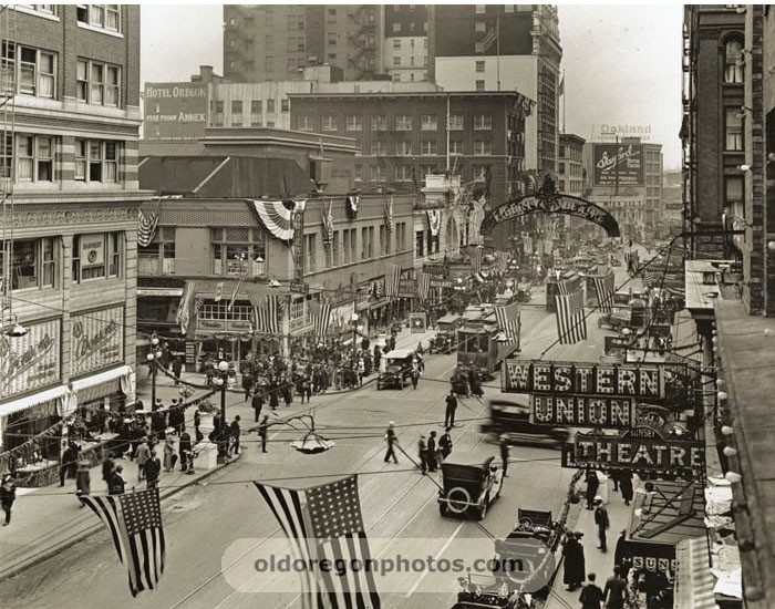
(1) 1918 SW Broadway, Portland
Post WWI: 1918-1925
In a time of extreme patriotism, as World War I was coming to an end and Americans were beginning to get back to their old hustle and bustle, the Portland City Council established its first Planning Commission in 1918 (2). 1918 truly marks the beginning of Portland’s land use history as we know it today, as the Commission ultimately went through with ambitious plans to ensure the City’s growth via housing, industry, and infrastructure; using the City of Berkeley, California as a model. After a couple of attempts, the Planning Commission finally passed the State’s first Zoning Ordinance, the 1924 Zoning Code (2).
At the time, there were no regulations regarding population density, building heights or land dimensions, just four simple zones; (I) Single Family, (II) Multi-Family, (III) Business-Manufacturing, and (IV) Unrestricted (2). Since there weren't any density regulations, many critics complained the Zoning plan allowed for too many Zone II residential buildings that sprawled out to the city limits and beyond, without much thought to municipalities such as sewer, water supply, schools, or roads in the outskirts at the time (2). However, the 1924 Zoning Code was instrumental to the development of Portland as a whole, and although the Code will be challenged in court many times in future years, these ordinances ultimately paved the way for modern planning in Portland (3).
At the time, there were no regulations regarding population density, building heights or land dimensions, just four simple zones; (I) Single Family, (II) Multi-Family, (III) Business-Manufacturing, and (IV) Unrestricted (2). Since there weren't any density regulations, many critics complained the Zoning plan allowed for too many Zone II residential buildings that sprawled out to the city limits and beyond, without much thought to municipalities such as sewer, water supply, schools, or roads in the outskirts at the time (2). However, the 1924 Zoning Code was instrumental to the development of Portland as a whole, and although the Code will be challenged in court many times in future years, these ordinances ultimately paved the way for modern planning in Portland (3).
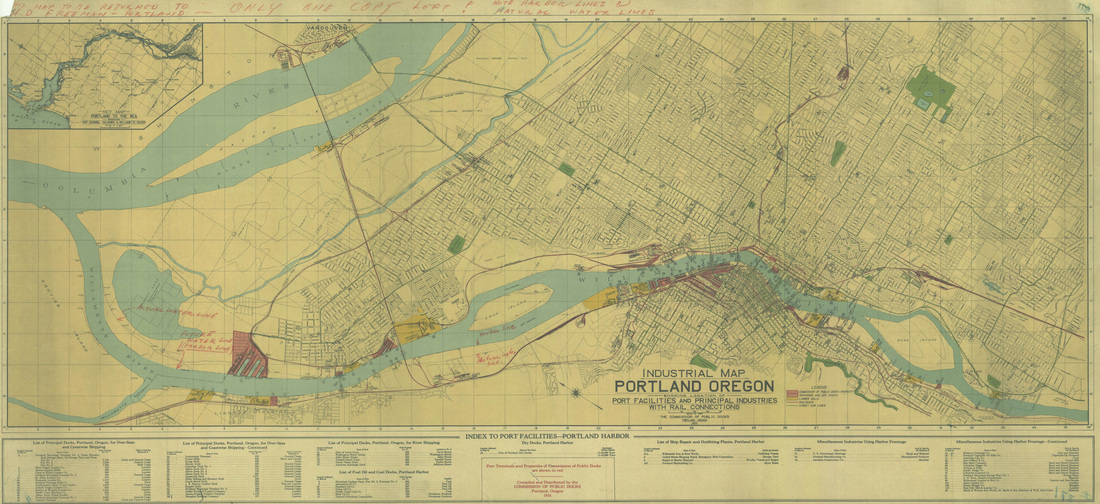
(4) 1924 Portland Industrial Map
1926-1943
In 1927, the City implemented a Major Streets Plan, which provided large arterial streets throughout the city center and towards a few key developments (2). In 1936, the Planning Commission developed a Public Recreation Report, which was potentially the best known Park Plan of the Country during this time period (2).
Post WWII: 1944-1956
In the mid-1940s, Portland leaders asked New York City planner Robert Moses to prepare a public improvement study that would draw more residents (5). In 1944, the Postwar Development Committee took a steadfast approach to public works development, with the implementation of the Moses Plan. The Moses Plan was one of the most aggressive and progressive postwar public works plans in the nation and focused on increased sewage infrastructure, schools, bridges, and local highways, including the Portland Loop, now known as I-405 Loop (3). The Loop provided excellent access the city center for commuters then and now.
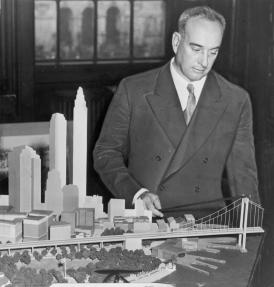
(5) Robert Moses
|
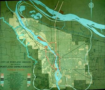
(5) The Moses Plan-Portland Public Works Improvement Map
|
1. (Image) Blendl, Alex. "SW Broadway, Portland, Oregon - 1918 -
Alex Blendl Prints - By Printmaker." OLD OREGON - The Art of Historic
Photos.
http://www.oldoregonphotos.com/printmaker/blendl/sw-broadway-portland-oregon.html
(accessed March 5, 2013).
2. Keefe, Lloyd. "History of Zoning in Portland 1918-1959." www.portlandoregon.gov/bps/article/147441 (accessed February 16, 2013).
3. McVoy, Arthur. "A History of City Planning in Portland, Oregon." Oregon Historical Quarterly 46, no. 1 (1945): 241-262. http://www.jstor.org/stable/20611594 (accessed February 16, 2013).
4. (Image) Commission of Public Docks. "Industrial Map of Portland, 1924 | Vintage Portland." http://vintageportland.wordpress.com/2013/01/11/industrial-map-of-portland-1924/ (accessed March 5, 2013).
5. (Image) "Robert Moses + Portland | Museum of the City." http://www.museumofthecity.org/exhibit/freeway-revolts-portland/robert-moses-portland (accessed March 5, 2013).
Jesse Ellison
