
Since 1990
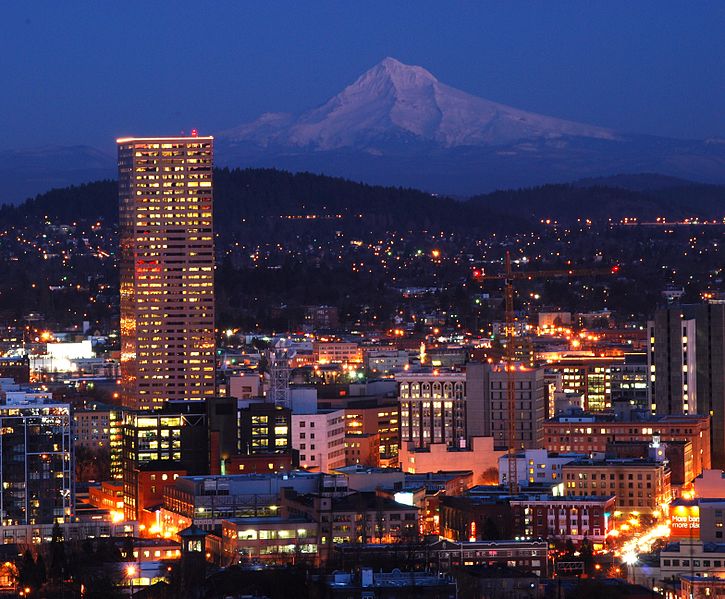
(1) Portland at Dusk
1990-1999
By the 1990s, the Metro Charter had developed some experience as a functioning MPO and was beginning to offer some key regional planning efforts. Overall, the land use planning efforts in the 90s focused on regional land use planning and began toying with the idea of stretching the urban growth boundary (UGB) (2).
The Future Vision Report was implemented in 1995 and was “a conceptual statement that indicates population levels and settlement patterns that the region can accommodate within the carrying capacity of the land, water and air resources of the region, and its educational and economic resources, and that achieves a desired quality of life.” (3).
1997 was a big year for the Portland area; as Metro adopted its first Regional Framework Plan (RFP), the Region 2040 Growth Concept (4) as well as the Regional Land Information System (RLIS) (5). The RFP was designed to provide long-term management of the region’s general growth concepts including urban growth boundaries, neighborhoods, and major corridors (4). The development of the RLIS was especially exciting for the Portland regions, as it provided a centralized enterprise GIS database for the planning community’s land management needs (6).
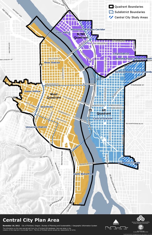
(7) Central City 2035 Plan Map
2000-Present
A major Metro regional land use event occurred in 2002, when the urban growth boundary was expanded (15). Approximately 19,000 acres were added to the urban growth boundary to provide 38,657 housing units and 2,671 acres for new jobs (8).
Then, likely the most important Plan ever adopted by Portland was just last year on April 25, 2012; The Portland Plan is the current Comprehensive Plan for the City (7). The Portland Plan focuses on equity, environmental health, and overall quality of life. However, the Planning Commission and local stakeholders are currently working on the Central City 2035 (CC2035) Plan which will amend the Portland Plan with the Central City Transportation Management Plan, and the Willamette Greenway Plan, and the 1988 Central City Plan, as well as all of the amendments that have been made since (7). The CC2035 Plan doesn't assume there is any new money coming in which allows the plan to remain realistic. As of now, the fate of Portland Land Use Planning rests in the visions and policies of soon to be Central City 2035 Comprehensive Plan.
Then, likely the most important Plan ever adopted by Portland was just last year on April 25, 2012; The Portland Plan is the current Comprehensive Plan for the City (7). The Portland Plan focuses on equity, environmental health, and overall quality of life. However, the Planning Commission and local stakeholders are currently working on the Central City 2035 (CC2035) Plan which will amend the Portland Plan with the Central City Transportation Management Plan, and the Willamette Greenway Plan, and the 1988 Central City Plan, as well as all of the amendments that have been made since (7). The CC2035 Plan doesn't assume there is any new money coming in which allows the plan to remain realistic. As of now, the fate of Portland Land Use Planning rests in the visions and policies of soon to be Central City 2035 Comprehensive Plan.
1. (Image) The Kiplinger Washington. "10 Good Reasons to
Move to Portland." http://activerain.com/blogsview/2486258/10-good-reasons-to-move-to-portland
(accessed March 5, 2013).
2. Ozawa, Connie. Seltzer, Ethan. "It’s Not an Experiment: Regional Planning at Metro, 1990 to the Present." In The Portland edge challenges and successes in growing communities. Washington, DC: Island Press, 2004. 35-40.
3. "Metro: Future Vision Report." Metro: Welcome to Metro. http://www.oregonmetro.gov/index.cfm/go/by.web/id=29886 (accessed March 5, 2013).
4. “Metro’s Regional Framework Plan.” Metro: Region 2040 Growth Concept. 1997. http://library.oregonmetro.gov/files//rfp.00_summary_2040_growth_concept_011311.pdf (accessed March 5, 201
5. Knapp, Gerrit. Bolen, Richard. Seltzer, Ethan. “Metro’s Regional Land Information System: The Virtual Key to Portland’s Growth Management Success.” WP99GK1. Cambridge: Lincoln Institute of Land Policy, 2003.
6. "Metro: RLIS Live, Geographic Information System data." Metro: Welcome to Metro. http://www.oregonmetro.gov/index.cfm/go/by.web/id=593 (accessed March 6, 2013).
7. "Project Overview | Central City 2035 | The City of Portland, Oregon." City of Portland, Oregon. http://www.portlandoregon.gov/bps/article/304042 (accessed March 3, 2013).
8. "Metro: Urban growth boundary." Metro: Welcome to Metro. http://www.oregonmetro.gov/index.cfm/go/by.web/id=277 (accessed March 6, 2013).
Jesse Ellison
